AARP Hearing Center
- right_container
- Health
- Money
- Work & Jobs
- Advocacy
- Social Security
- Medicare
- Caregiving
- Games
- Travel
- More...
- Entertainment & Style
- Family & Relationships
- Personal Tech
- Home & Living
- Auto
- Staying Sharp
- Podcasts
- Videos
McLaughlin Eastshore State Park State Seashore
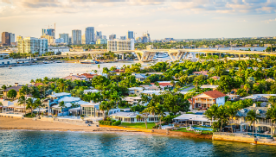
The park includes tidelands and upland property along 8.5 miles of shoreline of the San Francisco Bay. The park extends from the City of Richmond in the north to Emeryville and Oakland in the south, ending near the east anchorage of the San Francisco Bay Bridge. The tidelands comprise rich tidal marshes, sub tidal areas, and mudflats that extend bay ward from the shoreline including the Emeryville Crescent, Albany Mudflat, and Hoffman Marsh. Much of the existing upland area is the result of fill placement in the Bay west of the historic shoreline. The shoreline reflects the unique influences of both natural systems and human intervention.
BOATING
TRAIL USE
Bike Trails
Hiking Trails
DAY-USE ACTIVITIES & FACILITIES
Exhibits and Programs
Fishing
Guided Tours
Interpretive Exhibits
Beach Area
Swimming
Nature & Wildlife Viewing
Windsurfing/Surfing
Family Programs
AARP Events for Dell
-
Work on Improving Your Soft Pastel Skills!
Saturday, Jan 17, 2026 at 11:00 a.m. CT
Zoom
Online Event
-
Reimagine Your Next Chapter — and Thrive
Sunday, Jan 18, 2026 at 11:00 a.m. CT
Zoom
Online Event
-
Moving With Milly for Improved Mobility
Monday, Jan 19, 2026 at 10:00 a.m. CT
Zoom
Online Event

with Automatic Renewal
- Immediate access to your member benefits
- Discounts on travel and everyday savings
- Subscription to AARP The Magazine
- FREE second membership


