AARP Hearing Center
Grayson Highlands State Park
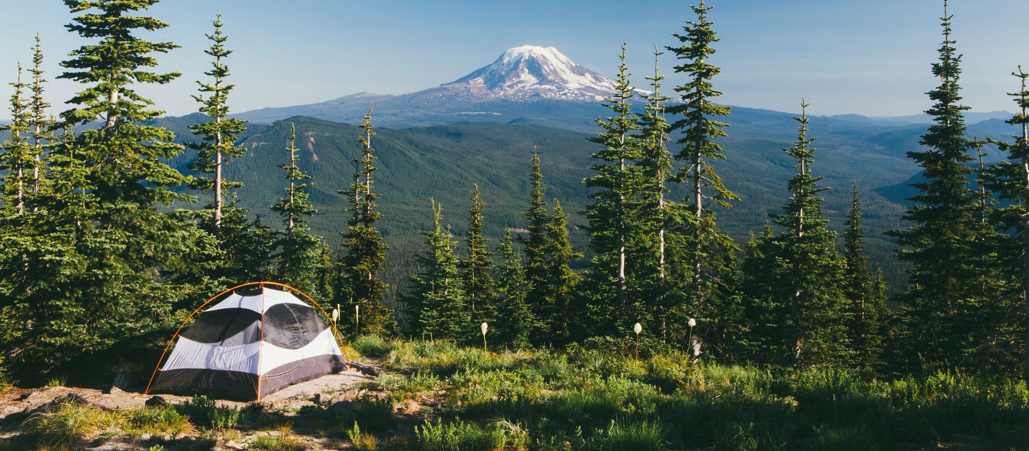
Near Mount Rogers and Whitetop Mountain, Virginia's two highest mountains, Grayson Highlands offers scenic views of alpine-like peaks more than 5,000 feet high. Facilities include a visitor center, campgrounds, and hiking trails leading to waterfalls and overlooks. Scenic horse trails and a horse camping area with electric and water hookups, stables and parking for trailers are available. The park provides year-round access to the Appalachian Trail and the Virginia Highlands Horse Trail.
Hours
8 a.m. - 10 p.m.
Camping
Grayson Highlands allows guests to reserve specific campsites.
Total sites of each type: E/W, 36. STD, 28. HorseE/W, 23. Wide Covered Stall, 20. OpnStall, 19. Wide Open Stall, 5. RV50-EW, 4. GrpTentStd (GT1), 1. CampLodge, 1.
Site type:
E/W - Electric and water sites; 20 and 30-amp; various equipment. Up to 40 feet. No horses allowed.
STD - Standard campsites; no hookups; various equipment. Up to 40 feet. One tent site is universally accessible. No horses allowed.
HorseE/W - Stable area campsites; electric and water hookups; 50-amp; various equipment. Up to 40 feet. Horses are allowed only in this area. Equestrian campers get priority booking, but any camper may make a reservation beginning 30 days prior to arrival. This area is also used for primitive camping in March, April and November.
Wide Covered Stall - Covered stalls for horses, about 8 x 10 feet; stable area; park provides sawdust for stalls. Bring your own hay bag and water bucket.
OpnStall - Open horse stalls, about 5 x 8 feet; some amenities in stalls. Bring your own hay bag and water bucket.
Wide Open Stall – Open horse stalls, about 8 x 10 feet; some amenities in stalls. Bring your own hay bag and water bucket.
GrpTentStd - Please see below for details.
Total campsites: 89
All campsites are dirt/gravel with picnic tables and grills at each site. Maximum of six campers per site.
Most sites are wooded; one site is universally accessible near bathhouse.
The horse campground is far from the park's other campgrounds.
Each site has a fire-ring for cooking and campfires.
Firewood and ice are available at the park.
Please deposit all trash in the dumpster as you exit the campground. Recycling containers are next to the dumpster.
No more than two vehicles and a camping unit are allowed per campsite. A parking fee will be charged for each additional vehicle.
There's additional parking beside and across from the Country Store.
Guests can visit overnight campers but must leave the park by 10 p.m.; no one is to roam around the park campground after 10 p.m.
Note: Primitive camping is centralized in stable area campground (HorseE/W) during March and April and in November; there are pit toilets only, and water is unavailable at this location. Drinking water is available in the park office from 8 a.m. to 4 p.m. daily and from an outside spigot after hours. Camping fees are lower during the primitive camping season.
Group Camping: Grayson Highlands has a group camping area (GrpTentStd).
This group camping area accommodates up to 35 campers. Sites have no water or electric hook-ups. No minimum number of campers to be considered a group.
A standard bathhouse is about 500 feet away, and water is available within 50 feet of the campground. Toilets are within 100 feet. Parking is available beside the camp store or a lot across from the store - campers will have to walk between 20 and 40 yards to reach the camping area. Tents only are permitted.
The group camping area is between the Country Store and the turn-off loop to the regular campground. The group area has five large tent pads, five picnic tables and three fire rings.
Groups may apply at the park for a special use permit allowing use of the amphitheater and a large fire ring. (This might prove useful for special ceremonies, such as those undertaken by scout groups.) There is a small processing fee for the permit, which must be approved two weeks beforehand. The permit must be arranged through the park.
The cancellation fee for group camping is higher than that for other camping.
Recreation
TRAILS
Hiking, bicycle trails (mountain bikes only), horse trails, self-guided trails.
Backpacking
The park has long been a gateway to the state’s highest peak, Mount Rogers, as well as the Appalachian Trail and the Grayson Highlands. As the popularity of outdoor recreation has grown, so has the number of visitors to the highlands. As many as 6,000 overnight visitors and many day hikers visit the area a year. This increased usage has raised concern for protection of the fragile highlands by the Mount Rogers National Recreation Area (MRNRA), the Appalachian Trail Conservancy (ATC) and Grayson Highlands State Park. Please abide by the following guidelines when planning a visit to the backcountry.
Weather at the park can be harsh, so those planning to access the AT from the park should be familiar with its severe weather policy and associated procedures.
Limit group sizes to no more than 10 in the high country and wilderness areas.
Shelters along the A.T. are intended for through or section hikers and groups of no more than four. Do not plan to stay at or camp near Thomas Knob Shelter or the Wise Shelter.
Backcountry camping is not allowed within Grayson Highlands State Park, including at Wise Shelter, but camping is allowed in the Mount Rogers National Recreation Area (MRNRA). Hikers traveling north on the A.T. will exit the park when they cross Big Wilson Creek just past the Wise Shelter fence are welcome to camp across the creek from the shelter, on the MRNRA.
Practice Leave No Trace.
Consider setting up your camp away from the A.T., perhaps off a horse trail or a foot trail in the area. Park staff would be happy to suggest various routes or camping locations. Feel free to call park staff when planning a visit.
Commercial groups must obtain a Special Use Permit from the U.S. Forest Service. This requirement is for paid guided hikes but does not apply to scouts, schools or church groups. Call the MRNRA Headquarters at 276-783-5196 for details.
Bridle trails: More than nine miles of bridle paths wander through the park. These paths also lead to bridle trails in Jefferson National Forest. Parking facilities for horse trailers and overnight stables are available at the park. The park does not provide horses for trail rides.
Hiking trails: The park has 13 hiking trails which vary from .5 to just over 2 miles in length. These trails lead to panoramic vistas, scenic waterfalls and a 200 year old pioneer cabin. The park also offers access to the Appalachian Trail and trails in the surrounding Jefferson National Forest. Details about the park's trails are listed below.
Grayson Highlands State Park Trails
Note: A detailed map of all trails in the Mount Rogers area can be purchased at the park office.
Key: F = Foot Traffic; H = Horseback Riding; B = Mountain Bikes; X = Cross Country Skiing
Appalachian Spur Trail: mileage .8; F
Appalachian Trail: mileage (within park) 2.5; F
Rhododendron Trail: mileage 1.0; F, X
Cabin Creek Trail: mileage 1.8 loop; F
Big Pinnacle Trail: mileage 0.4; F
Twin Pinnacles Trail: mileage 1.6; F
Listening Rock Trail: mileage 1.4 loop; F
Haw Flats Trail: mileage .7 loop; F
Split Rock Trail: mileage .3 loop; F
Wilson Creek Trail: mileage 1.8; F
Wilburn Branch Trail: mileage 2.3; F, B
Stampers Branch Trail: mileage 1.7; F
Rock House Ridge Trail: mileage 1.3 loop; F
Horse Trail (east): mileage 3.2; H, F, B, X
Horse Trail (north): mileage 2.0; H, F, X
Seed Orchard Road: mileage 1.2; H, F, B, X
Old Upchurch Road: mileage 3.3; H, F, B, X
Wild Ponies
Hikers on the highlands trails are likely to encounter wild ponies. They were introduced to the park in 1974 to prevent reforestation of the highland balds. The pony herd is managed by the Wilburn Ridge Pony Association. During fall roundups of ponies for an auction held in conjunction with Grayson Highland’s annual Fall Festival, association members check the herd for health problems.
Visitors should not approach, feed or pet the ponies. They bite and kick when they feel threatened, and human food is bad for them.
Bouldering
Grayson Highlands is known as the best bouldering site in Virginia. On the park’s mountainous slopes are four main boulder fields and three smaller fields with more than 700 named climbing routes, also known as problems. The park’s geology, which is unique in the Southeast, makes it well-suited to bouldering. Climbers will find rhyolite at higher elevations as well as a metaconglomerate in a quartzite matrix elsewhere in the park. These provide steep faces with angular features including rails, flakes and edges that ensure bouldering opportunities for climbers of all skill levels.
Summer weather at the park is ideal for bouldering. Several boulder fields have an elevation of more than 4,900 feet, with temperatures in the 70s and cool breezes that allow climbing throughout summer.
The park welcomes climbers to enjoy bouldering opportunities but requires that Leave No Trace ethics be followed. Ropes and the chipping of rocks are not allowed. Climbing is inherently dangerous; all safety precautions should be taken. Stop by the contact station or office to register as a climber in case of emergency.
The park has four crash pads for rent. It also sells chalk, chalk bags and the Grayson Highlands Bouldering Guidebook. For more information about the bouldering opportunities at Grayson Highlands, visit the Mountain Project.
SWIMMING
None at this park.
FISHING, BOATING
Nearly 10 miles of wild trout streams lie within Grayson Highlands State Park. Cool mountain streams offer anglers native brook and wild rainbow trout as well as breathtaking scenery. All the streams in the park are Special Regulation Wildlife Trout Streams which require the use of single hooks and artificial lures, and all trout less than nine inches long must be released unharmed. All required state fishing licenses and creel limits apply to fishing within the park. A National Forest Permit is required when fishing national forest property, which borders the park along Wilson Creek.
Guided canoe trips are offered from Memorial Day through Labor Day, depending on the water level of the river. The trips can accommodate groups of from six to 14. The trip takes place on the New River through "a land that time forgot." Take in cliffs, shaded pastures, lush woodlands and crisp, clear water. It's a six-mile trek and takes about six hours. Participants should bring lunch, drinking water and closed-toe shoes.
Big Wilson Creek, along the northeastern boundary of the park, offers 3.5 miles of fishable waters. From its headwaters to ¼-mile below it confluence with Little Wilson Creek, the stream is designated a "Special Regulation Wild Trout Stream." A sign marks the area. Below this point, the creek is designated a "Stocked Trout Stream" and requires a trout license in addition to the state fishing license. You can reach the creek via the Appalachian Trail at Massie Gap or by taking the Big Wilson Creek Trail from the main campground.
Wilburn Branch, near the central area of the park, provides 1.8 miles of fishable waters and is designated a "Special Regulation Wild Trout Stream." It can be accessed via the Stamper's Branch or Upchurch Road trail.
Mill Creek, which has 1.1 miles of fishable waters, is the park's southeastern corner. It too is a "Special Regulation Wild Trout Stream." Get there by taking Highway 58 East from the park's entrance, then turning left on SR 742 (Mill Creek Rd.). Access to the park's portion of the creek is on the left near a grove of white pines, about half a mile down Mill Creek Rd.
Quebec Branch, in the park's northern region, has 1.1 miles of fishable waters, all of which is designated a "Special Regulation Wild Trout Stream." This waterway sometimes has low water. Access it from the Appalachian Trail at Massie Gap or by taking the Seed Orchard Road Trail from Hickory Ridge Campground.
Cabin Creek of the park's western area has 2.1 miles of fishable water, all of which is designated a Special Regulation Wild Trout Stream. Wild rainbow and native brook trout inhabit the waters here; it's not stocked. Take the Cabin Creek Trail at Massie Gap to get there.
HORSES
Horse trails and horse camping facilities are available here, but no horses are for rent. See the park's camping description for information about overnight horse facilities here. State law requires that visitors carry a copy of a negative Coggins report with each horse brought to the park.
AARP Events for Jamesport
-
Featured Event
Downsizing and Decluttering
Wednesday, Mar 18, 2026 at 2:30 p.m. ET
AARP State Office
New York, NY
-
Clean the Green Way
Thursday, Jan 22, 2026 at 10:00 a.m. ET
Zoom
Online Event
-
Master Zoom Essentials to Connect Confidently
Thursday, Jan 22, 2026 at 12:00 p.m. ET
Zoom
Online Event

with Automatic Renewal
- Immediate access to your member benefits
- Discounts on travel and everyday savings
- Subscription to AARP The Magazine
- FREE second membership


