
AARP Hearing Center
CLOSE ×
Search
Popular Searches
Suggested Links

AARP Membership — $15 for your first year when you sign up for Automatic Renewal
Get instant access to members-only products and hundreds of discounts, a free second membership, and a subscription to AARP the Magazine.


Flexible Work

AARP Skills Builder

Flexible Work

ON-DEMAND WEBINARS

Drug Prices

Social Security

Medicare & Medicaid

Caregiving

Webinars

Enrollment

Basics


LONG-TERM CARE

State Guides

Prepare to Care Guides

End of Life


Movies for Grownups


Home Technology

Get Happier

Virtual Community Center


Chapman State Park
4790 Chapman Dam Road
Clarendon,
PA
16313
By clicking the links above, you'll leave AARP and go to a website that is not operated by AARP. A different privacy policy and terms of service will apply.
814-723-0250
The 805-acre Chapman State Park includes the 68-acre Chapman Lake on the West Branch of Tionesta Creek.
Adjacent to state game lands and the Allegheny National Forest, Chapman is an oasis of recreational facilities in a vast area of wilderness.
Hiking at Chapman State Park
14 miles of trails
Chapman State Park is in the midst of about 517,000 acres of Allegheny National ForestOpens In A New Window and State Game Lands 29.
When going on a hike, always take a map and compass and know how to use them.
Leave word with a family member, friend, or the park office concerning the trails you will take, destination, and expected return time.
Adams Run Trail
0.4 mile, easiest hiking, yellow blazes
The trail head is near the restroom at the base of the sledding hill and follows Adams Run up a gradual grade until the trail ends at Hunters Ridge Trail. There is a 0.25 mile parallel trail on the opposite side of Adams Run to make a shorter loop out of the first half of the trail.
There are many wet areas, especially in the spring, which may persist throughout the summer. This trail is for hiking and experienced cross-country skiing.
Crooked Pine Trail
0.5 mile, most difficult hiking, yellow blazes
A short connector trail between Hunters Ridge Trail and the Group Tenting Area parking lot, this trail is steep and meanders through several different forest types. This trail is for hiking only.
Game Lands Road
6 miles, more difficult hiking, no blazes
An easy trail which is quite flat over its entire length, the road runs from the parking lot near the group tenting area, 0.5 miles within the park, continuing through State Game Lands 29, and eventually to Dunham Siding or Hermit Springs. It also may be accessed from the campground by using the Old Railroad Grade/Lowlands Trail. The road is gated at both ends and has many turn offs, which may or may not be gated.
Foot, horse, and bicycle travel is allowed only on designated trails and roads, marked by a green triangle sign. Trails and roads marked with a red triangle sign allow foot travel only. (Foot traffic includes cross-country skiing.) Trails are closed for bicycles and horses from the last Saturday in September to the third Saturday in January unless the visitor is hunting or fishing. The trails are open Sundays during this time.
Hunters Ridge Trail
2.75 miles, most difficult hiking, yellow blazes
Much of this trail is rugged and hilly. Be conscientious of your ability and health. One end of the trail is on Forest Road 437 near the park office and the other end is near the parking lot at the end of the Game Land Road. A loop can be made by following Game Land Road and Warming Hut Trail.
There are many wet areas, especially in the spring, which may persist throughout the summer. At times, the trail follows the boundary between the park and the state game lands. (This boundary is blazed in white. Do not mistake it for the trail.)
The trail also crosses many oil lease roads. Be careful to find the blazes on the other side of the road. DO NOT follow these roads! They are many miles long and have numerous, confusing turn offs. This trail is for hiking only.
Lowlands Trail
0.3 miles, easiest hiking, blue blazes
One end of the trail is on the Game Land Road and the other is between sites #23 and #25 of the campground. It is an easy trail along an old railroad grade, across the Swinging Bridge over the West Branch of Tionesta Creek, and through a wetland area above the lake.
The Old Railroad Grade may be followed past the Swinging Bridge through State Game Lands 29 where it connects with the Game Land Road. This trail is for hiking, bicycling, and cross-country skiing. Bicyclers and skiers should be very careful crossing the Swinging Bridge and its steps.
Lumber Trail
0.7 mile, easiest hiking, orange and yellow blazes
This trail is suitable for hikers of all ages. The first portion of the trail is shared with the Allegheny National Forest Snowmobile Trail, blazed with orange diamonds, and is easy with little grade. The trailhead is along the Main Park Road between the beach and the campground.
The trail uses an abandoned logging road as its base, and evidence of the lumbering activity can still be seen along the length of the trail. This trail is for hiking. Bicycling and snowmobiling is permitted only on the portion shared with the snowmobile trail.
Nature Trail
1.2 miles, easiest hiking, yellow blazes
Suitable for hikers of all ages, the trail is mostly level along the lakeshore, but has some short, steep hills around the Upper Loop of the campground. One end of the trail is along the service road near the amphitheater and the other is located partway up Lumber Trail. A short loop can be made where the trail splits behind the Upper Loop of the campground. This short section starts along the road near the campground host site and RV dump station. This trail is for hiking only.
The section of the Nature Trail from the amphitheater to Old Railroad Grade/Lowlands trail is a self-guiding trail with interpretive signs at ten designated points of interest. The order of the signs is intended to start at the amphitheater, but can be followed in either direction.
Orchard Trail
0.13 mile, easiest hiking, yellow blazes
A short connector trail between the Warming Hut Trail and Hunters Ridge Trail, this trail is moderately steep and travels through an old apple orchard. This trail is for hiking only.
Penny Run Trail
1.4 miles, more difficult hiking, blue blazes
Hiking difficulty is moderate with steady uphill grades. One end of the trail is across the Main Park Road from the Spillway Parking Lot and the other is across the Main Park Road from the Pavilion #2 Parking Lot. The trail travels through diverse hardwood and hemlock forest in the park and in the neighboring Allegheny National Forest.
This trail is usually wet, with some spots persisting throughout the year. This trail is for hiking and experienced cross-country skiing.
Warming Hut Trail
0.7 mile, easiest hiking, orange diamond blazes
This moderately easy trail follows the lakeshore and climbs a gradual hill above the dam. One end of the trail is across Forest Road 437 from the office and the other is at the warming hut. This trail is for hiking, snowmobiling, bicycling, and cross-country skiing.
Backpacking
In addition to the trails at the park, Chapman State Park serves as a trailhead for backpacking trails on adjoining public lands.
Map and trail information is available in the park office.
Free parking is available at the park for those who would rather not leave their vehicles along public roadways.
Please sign in at the park office.
Picnicking
The main picnic area is by the beach and overlooks the lake.
Five picnic pavilions may be reserved up to 11 months in advance for a fee. Unreserved picnic pavilions are free on a first-come, first-served basis.
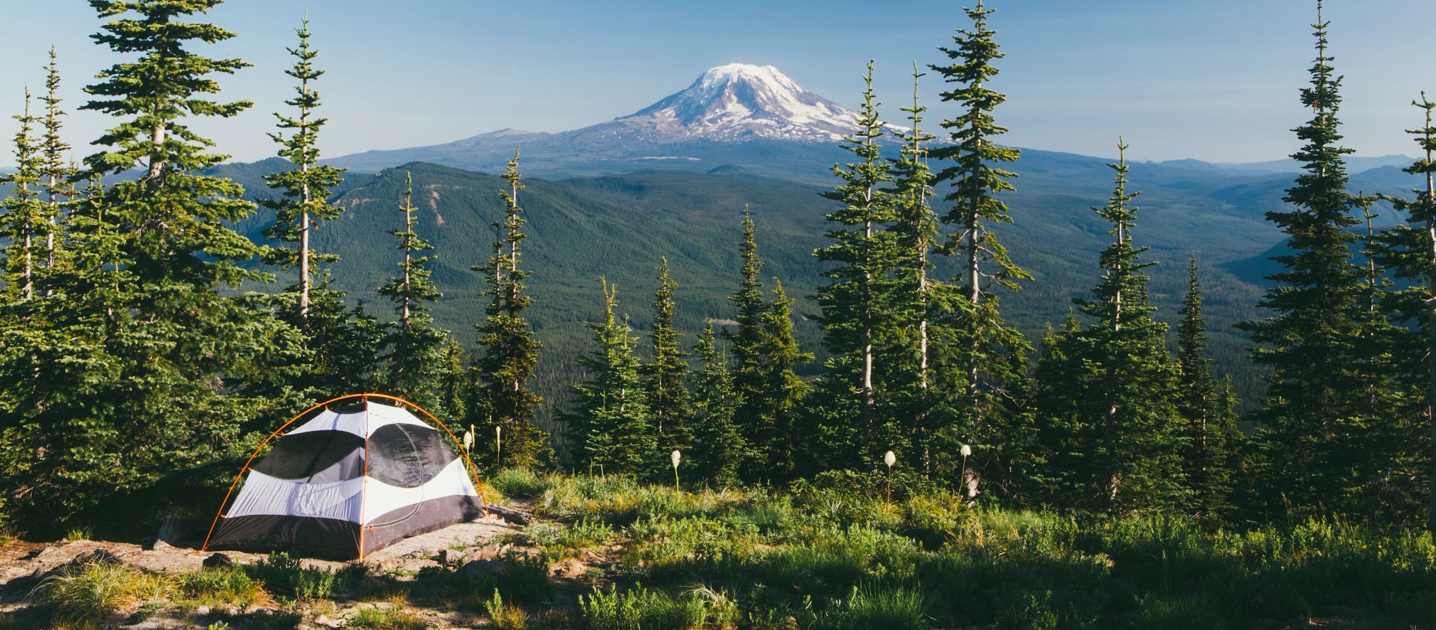
Stay the Night at Chapman State Park
Camping
flush toilets, warm showers, electric hook-ups
This beautiful woodland campground has 82 campsites, modern restrooms, water at convenient hydrants, and a sanitary dump station.
The campground is open from mid-April to mid-December. Winter access cannot be guaranteed and can be checked by contacting the park office.
Pets are permitted at designated campsites.
Swimming
A sand beach is open from late-May to mid-September, from 8:00 A.M. until sunset.
Swim at your own risk. Please read and follow posted rules.
Smoke-Free Beach
Smoking is prohibited on the beach and in the swimming area. For visitors who smoke and still want to use the beach, designated areas adjacent to the beach are provided. The restriction includes:
Cigarettes
Pipes
Cigars
E-cigarettes
Other handheld, lighted smoking devices
Concession Stand
A concession stand is located at the beach area. The concession offers beverages, snacks, ice cream treats, and ice.
Boating
electric motors only
The 68-acre Chapman Lake has a boat launch and 41 seasonal mooring spaces on the western side, and mooring for registered campers on the eastern shoreline.
Motorboats must display a boat registration from any state. Non-powered boats must display one of the following:
Boat registration from any state
Launch permit or mooring permit from Pennsylvania state parks that are available at most state park offices
Launch use permit from the Pennsylvania Fish and Boat Commission
Pennsylvania Fish and Boat Commission regulations and laws apply.
Fishing at Chapman State Park
The 68-acre Chapman Lake has fishing for coldwater and warmwater fish, including:
Brook and brown trout
Largemouth bass
Bluegill
Sunfish
Yellow perch
******
This activity or structure is ADA accessible. ADA accessible fishing piers are on the eastern and western shorelines of Chapman Lake.
Within the park and the surrounding Allegheny National Forest, trout fishing exists in the West Branch of Tionesta Creek and Farnsworth Run.
Ice Fishing
The 68-acre Chapman Lake is popular for ice fishing for perch and trout.
Ice thickness in not monitored.
Hunting and Firearms
During established seasons, more than 400 acres are open to:
Hunting
Trapping
Training of dogs
Common game species are:
Deer
Turkey
Bear
Small game
Allegheny National Forest and State Game Lands 29 adjacent to the park are open to hunting.
Special Canada goose hunting regulations are in place. Contact the park office for more information.
Hunting woodchucks, also known as groundhogs, is prohibited. Dog training is only permitted from the day following Labor Day through March 31 in designated hunting areas.
DCNR and the Pennsylvania Game Commission rules and regulations apply.
This activity or structure is ADA accessible. Contact the park office for ADA accessible hunting information.
Use extreme caution with firearms at all times. Other visitors use the park during hunting seasons. Firearms and archery equipment used for hunting may be uncased and ready for use only in authorized hunting areas during hunting seasons.
In areas not open to hunting or during non-hunting seasons, firearms and archery equipment shall be kept in the owner's vehicle or enclosed trailer. Exceptions include law enforcement officers and individuals with a valid Pennsylvania License to Carry Firearms are authorized to carry a firearm concealed on their person while they are within a state park.
Biking
Although most hiking trails are not open to bicycles, all roads in the park, in the adjacent state game lands, and in Allegheny National Forest are open to bicycles.
Sledding at Chapman State Park
A seven-acre, groomed slope on the western side of the park is lighted each evening until 10:00 P.M.
Cross-country Skiing at Chapman State Park
At least 4.4 miles of groomed ski trails within the park connect to numerous trails in the adjoining national forest and state game lands.
Ice Skating at Chapman State Park
Ice Rink
An ice rink is located across from the park office, behind the Environmental Learning Center.
Constructed during 2011, this 120 foot x 80 foot, on-the-ground rink is lighted nightly until 9:00 P.M. when conditions permit.
Skates only permitted on the ice rink. Footprints on snow and slush can freeze and create hazardous conditions for skaters.
Lake Skating
Ice skating is permitted on the natural ice of Chapman Lake, as conditions permit.
Ice thickness is not monitored.
Snowmobiling at Chapman State Park
Chapman is a trailhead to more than 300 miles of trails in Allegheny National Forest. Many of these trails are groomed depending on conditions.
The trails are open after the end of deer season in late December through March 31.
Snowmobiles must stay on designated trails and have a current registration.
Chapman State Park provides ample trailer parking, heated restrooms, and a warming hut.
AARP Events for Hector
-
Featured Event
Key Questions to Consider: Medicare Enrollment
Wednesday, Mar 18, 2026 at 1:00 p.m. ET
Zoom
Online Event
-
Featured Event
Filing for Social Security
Wednesday, Mar 25, 2026 at 1:00 p.m. ET
Zoom
Online Event
-
Gentle Chair Yoga With Guided Breathing
Friday, Jan 30, 2026 at 8:30 a.m. ET
Zoom
Online Event

Only $15 your first year
with Automatic Renewal
with Automatic Renewal
- Immediate access to your member benefits
- Discounts on travel and everyday savings
- Subscription to AARP The Magazine
- FREE second membership
Join AARP
Already a member? Renew or
Print Card