
AARP Hearing Center
CLOSE ×
Search
Popular Searches
Suggested Links

AARP Membership — $15 for your first year when you sign up for Automatic Renewal
Get instant access to members-only products and hundreds of discounts, a free second membership, and a subscription to AARP the Magazine.


Flexible Work

AARP Skills Builder

Flexible Work

ON-DEMAND WEBINARS

Drug Prices

Social Security

Medicare & Medicaid

Caregiving

Webinars

Enrollment

Basics


LONG-TERM CARE

State Guides

Prepare to Care Guides

End of Life


Movies for Grownups


Home Technology

Get Happier

Virtual Community Center


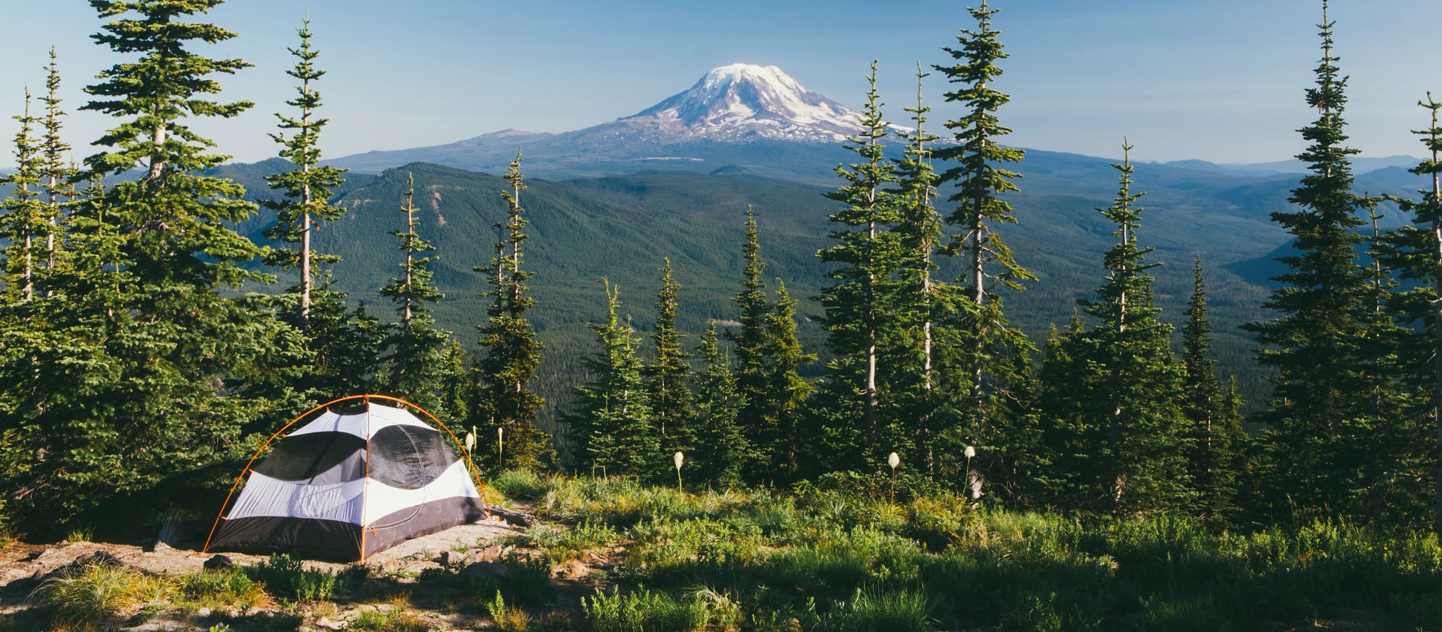
Bill Williams Mountain Trail
Williams,
AZ
86046
By clicking the links above, you'll leave AARP and go to a website that is not operated by AARP. A different privacy policy and terms of service will apply.
This trail starts in ponderosa pine and oak thickets. As it crosses West Cataract Creek, it goes through stands of aspen and fir carpeted by a dense ground cover of ferns, Oregon grape and Arizona wild rose. At several places on the trail, the hiker has a good view of the valley below and the peaks in the distance. There is no water available along the trail, but cool summer temperatures make this an enjoyable hike.
Bill Williams Mountain marks the traditional boundary of lands inhabited by the early ancestors of the Hopi people. Your respectful use of this area while you are visiting here will be appreciated. This trail was originally built as a “toll road” in 1902. Builder Esau Lamb charged hikers and horseback riders a fee to ride to the top.
This is a short (day) hike, with moderately difficult slopes going up the mountain and easy down-grades coming back down. If arrangements can be made for someone to drive to the top of the mountain on FR 111 and meet the hikers, a one way trip is possible. The trail ends near the end of the road at 9256 feet. By leaving a vehicle at Camp Clover and also at the start of Benham Trail, day-hikers can go up one trail and down the other for a total hike of about 8.5 miles. It is also possible to connect with the Bixler Saddle Trail #72, the Buckskinner Trail #130 via the Clover Spring Loop #46, or the City of Williams Link Trail #124.
AARP Events for Hemet
-
Featured Event
Meet the L.A. Soul Steppers Walking Group
Tuesday, Feb 10, 2026 at 8:00 a.m. PT
Crenshaw Family YMCA
Los Angeles, CA
-
Featured Event
Join Cupid Crew in San Diego
Wednesday, Feb 11, 2026 at 11:30 a.m. PT
Meals on Wheels
San Diego, CA
-
Featured Event
Join Cupid Crew in Chula Vista
Thursday, Feb 12, 2026 at 11:30 a.m. PT
Norman Park Senior Center
Chula Vista, CA

Only $15 your first year
with Automatic Renewal
with Automatic Renewal
- Immediate access to your member benefits
- Discounts on travel and everyday savings
- Subscription to AARP The Magazine
- FREE second membership
Join AARP
Already a member? Renew or
Print Card